| diagram |
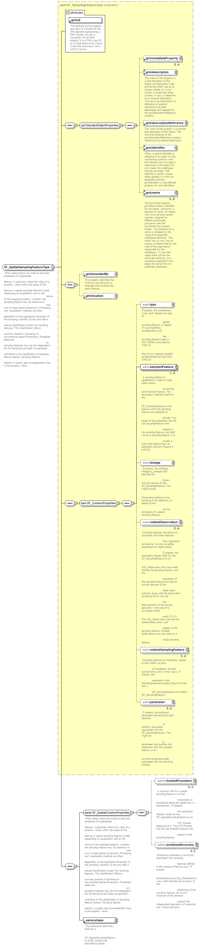 |
| namespace |
http://www.opengis.net/samplingSpatial/2.0 |
| type |
extension of sam:SF_SamplingFeatureType |
| properties |
| base | sam:SF_SamplingFeatureType |
|
| children |
gml:metaDataProperty gml:description gml:descriptionReference gml:identifier gml:name gml:boundedBy gml:location sam:type sam:sampledFeature sam:lineage sam:relatedObservation sam:relatedSamplingFeature sam:parameter sams:hostedProcedure sams:positionalAccuracy sams:shape |
| attributes |
| Name | Type | Use | Default | Fixed | annotation | | id | | required | | | | documentation | | The attribute gml:id supports provision of a handle for the XML element representing a GML Object. Its use is mandatory for all GML objects. It is of XML type ID, so is constrained to be unique in the XML document within which it occurs. |
|
|
| annotation |
| documentation | When observations are made to estimate properties of a geospatial
feature, in particular where the value of a property varies within the scope of the
feature, a spatial sampling feature is used. Depending on accessibility and on the
nature of the expected property variation, the sampling feature may be extensive in
one, two or three spatial dimensions. Processing and visualization methods are often
dependent on the topological dimension of the sampling manifold, so this provides a
natural classification system for sampling features. This classification follows
common practice in focussing on conventional spatial dimensions. Properties observed
on sampling features may be time-dependent, but the temporal axis does not generally
contribute to the classification of sampling feature classes. Sampling feature
identity is usually less time-dependent than is the property value. |
|