| diagram | 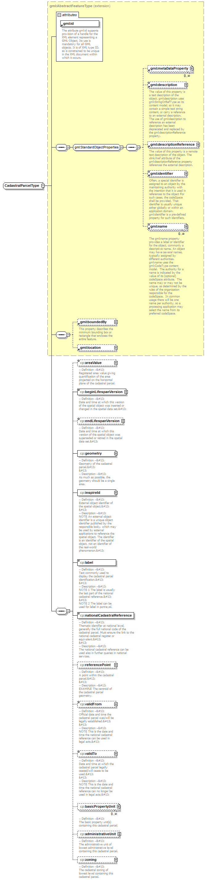 |
||||||||||||||
| namespace | urn:x-inspire:specification:gmlas:CadastralParcels:3.0 | ||||||||||||||
| type | extension of gml:AbstractFeatureType | ||||||||||||||
| properties |
|
||||||||||||||
| children | gml:metaDataProperty gml:description gml:descriptionReference gml:identifier gml:name gml:boundedBy gml:location cp:areaValue cp:beginLifespanVersion cp:endLifespanVersion cp:geometry cp:inspireId cp:label cp:nationalCadastralReference cp:referencePoint cp:validFrom cp:validTo cp:basicPropertyUnit cp:administrativeUnit cp:zoning | ||||||||||||||
| attributes |
|
element CadastralParcelType/areaValue
| diagram | 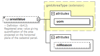 |
||||||||||||||||||
| namespace | urn:x-inspire:specification:gmlas:CadastralParcels:3.0 | ||||||||||||||||||
| type | extension of gml:AreaType | ||||||||||||||||||
| properties |
|
||||||||||||||||||
| attributes |
|
||||||||||||||||||
| annotation |
|
attribute CadastralParcelType/areaValue/@nilReason
| type | gml:NilReasonType | ||
| properties |
|
element CadastralParcelType/beginLifespanVersion
| diagram | 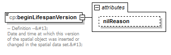 |
||||||||||||
| namespace | urn:x-inspire:specification:gmlas:CadastralParcels:3.0 | ||||||||||||
| type | extension of dateTime | ||||||||||||
| properties |
|
||||||||||||
| attributes |
|
||||||||||||
| annotation |
|
attribute CadastralParcelType/beginLifespanVersion/@nilReason
| type | gml:NilReasonType | ||
| properties |
|
element CadastralParcelType/endLifespanVersion
| diagram | 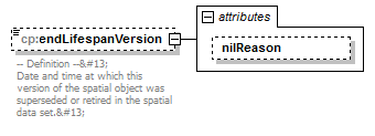 |
||||||||||||
| namespace | urn:x-inspire:specification:gmlas:CadastralParcels:3.0 | ||||||||||||
| type | extension of dateTime | ||||||||||||
| properties |
|
||||||||||||
| attributes |
|
||||||||||||
| annotation |
|
attribute CadastralParcelType/endLifespanVersion/@nilReason
| type | gml:NilReasonType | ||
| properties |
|
element CadastralParcelType/geometry
| diagram | 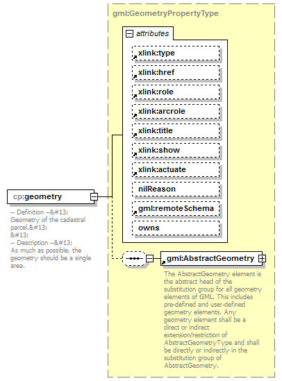 |
||||||||||||||||||||||||||||||||||||||||||||||||||||||||||||||||||||
| namespace | urn:x-inspire:specification:gmlas:CadastralParcels:3.0 | ||||||||||||||||||||||||||||||||||||||||||||||||||||||||||||||||||||
| type | gml:GeometryPropertyType | ||||||||||||||||||||||||||||||||||||||||||||||||||||||||||||||||||||
| properties |
|
||||||||||||||||||||||||||||||||||||||||||||||||||||||||||||||||||||
| children | gml:AbstractGeometry | ||||||||||||||||||||||||||||||||||||||||||||||||||||||||||||||||||||
| attributes |
|
||||||||||||||||||||||||||||||||||||||||||||||||||||||||||||||||||||
| annotation |
|
element CadastralParcelType/inspireId
| diagram | 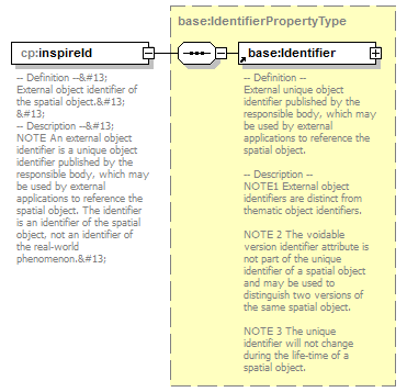 |
||||
| namespace | urn:x-inspire:specification:gmlas:CadastralParcels:3.0 | ||||
| type | base:IdentifierPropertyType | ||||
| properties |
|
||||
| children | base:Identifier | ||||
| annotation |
|
element CadastralParcelType/label
| diagram | 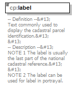 |
||||
| namespace | urn:x-inspire:specification:gmlas:CadastralParcels:3.0 | ||||
| type | string | ||||
| properties |
|
||||
| annotation |
|
element CadastralParcelType/nationalCadastralReference
| diagram | 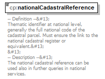 |
||||
| namespace | urn:x-inspire:specification:gmlas:CadastralParcels:3.0 | ||||
| type | string | ||||
| properties |
|
||||
| annotation |
|
element CadastralParcelType/referencePoint
| diagram | 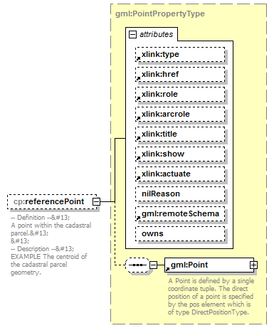 |
||||||||||||||||||||||||||||||||||||||||||||||||||||||||||||||||||||
| namespace | urn:x-inspire:specification:gmlas:CadastralParcels:3.0 | ||||||||||||||||||||||||||||||||||||||||||||||||||||||||||||||||||||
| type | gml:PointPropertyType | ||||||||||||||||||||||||||||||||||||||||||||||||||||||||||||||||||||
| properties |
|
||||||||||||||||||||||||||||||||||||||||||||||||||||||||||||||||||||
| children | gml:Point | ||||||||||||||||||||||||||||||||||||||||||||||||||||||||||||||||||||
| attributes |
|
||||||||||||||||||||||||||||||||||||||||||||||||||||||||||||||||||||
| annotation |
|
element CadastralParcelType/validFrom
| diagram | 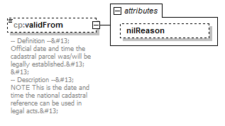 |
||||||||||||
| namespace | urn:x-inspire:specification:gmlas:CadastralParcels:3.0 | ||||||||||||
| type | extension of dateTime | ||||||||||||
| properties |
|
||||||||||||
| attributes |
|
||||||||||||
| annotation |
|
attribute CadastralParcelType/validFrom/@nilReason
| type | gml:NilReasonType | ||
| properties |
|
element CadastralParcelType/validTo
| diagram | 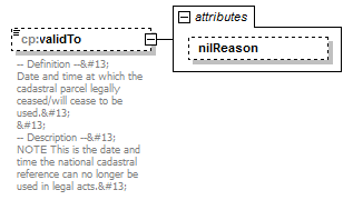 |
||||||||||||
| namespace | urn:x-inspire:specification:gmlas:CadastralParcels:3.0 | ||||||||||||
| type | extension of dateTime | ||||||||||||
| properties |
|
||||||||||||
| attributes |
|
||||||||||||
| annotation |
|
attribute CadastralParcelType/validTo/@nilReason
| type | gml:NilReasonType | ||
| properties |
|
element CadastralParcelType/basicPropertyUnit
| diagram | 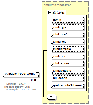 |
||||||||||||||||||||||||||||||||||||||||||||||||||||||||||||||||||||
| namespace | urn:x-inspire:specification:gmlas:CadastralParcels:3.0 | ||||||||||||||||||||||||||||||||||||||||||||||||||||||||||||||||||||
| type | gml:ReferenceType | ||||||||||||||||||||||||||||||||||||||||||||||||||||||||||||||||||||
| properties |
|
||||||||||||||||||||||||||||||||||||||||||||||||||||||||||||||||||||
| attributes |
|
||||||||||||||||||||||||||||||||||||||||||||||||||||||||||||||||||||
| annotation |
|
element CadastralParcelType/administrativeUnit
| diagram | 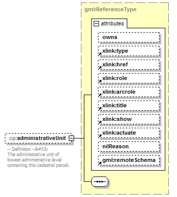 |
||||||||||||||||||||||||||||||||||||||||||||||||||||||||||||||||||||
| namespace | urn:x-inspire:specification:gmlas:CadastralParcels:3.0 | ||||||||||||||||||||||||||||||||||||||||||||||||||||||||||||||||||||
| type | gml:ReferenceType | ||||||||||||||||||||||||||||||||||||||||||||||||||||||||||||||||||||
| properties |
|
||||||||||||||||||||||||||||||||||||||||||||||||||||||||||||||||||||
| attributes |
|
||||||||||||||||||||||||||||||||||||||||||||||||||||||||||||||||||||
| annotation |
|
element CadastralParcelType/zoning
| diagram | 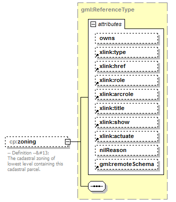 |
||||||||||||||||||||||||||||||||||||||||||||||||||||||||||||||||||||
| namespace | urn:x-inspire:specification:gmlas:CadastralParcels:3.0 | ||||||||||||||||||||||||||||||||||||||||||||||||||||||||||||||||||||
| type | gml:ReferenceType | ||||||||||||||||||||||||||||||||||||||||||||||||||||||||||||||||||||
| properties |
|
||||||||||||||||||||||||||||||||||||||||||||||||||||||||||||||||||||
| attributes |
|
||||||||||||||||||||||||||||||||||||||||||||||||||||||||||||||||||||
| annotation |
|
XML Schema documentation generated by XMLSpy Schema Editor http://www.altova.com/xmlspy